

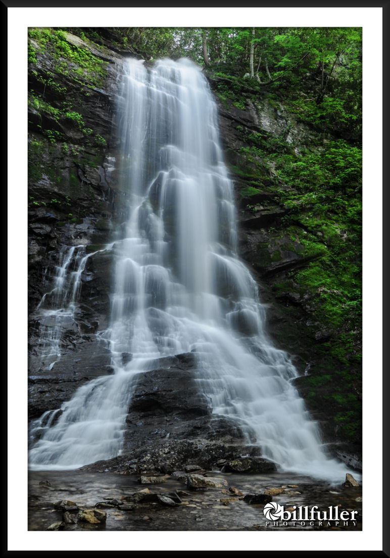
Sill Branch Falls
Sill Branch Falls is located in the scenic Clark’s Creek area of Unicoi County, Tennessee just off of State Route 81/107 West. With a round-trip of just over a mile, this is a wonderful trek for families and beginners to one of the most stunning waterfalls in our region.
This hike is a little uphill but not drastically, and there is one (normally shallow) stream crossing, so bring dry socks if you feel the need. The walk mostly follows in close proximity to the Sill Branch stream so there are plenty of spots to take in the beautiful cascades along the way.
The best time to go is after a decent rain, as this stream can have low flow in dry summer months. And, the area also has an abundance of wildflowers in the spring months.
Read the HIKE PLANNER for further information, but one tip to remember:
When the trail splits (which it does only once), take the trail to the left!
 SILL BRANCH FALLS Overall Recommendation: Hikers of all skill levels. Great family hike! Spring months for wildflowers. Wait on a good rain before going. Outstanding Features: Scenic 60′ waterfall. Difficulty: Easy Driving: From Johnson City: Take I-26 to the Erwin/Jonesborough exit (#37). At the end of the ramp turn right and take State Rt. 81/107 for 6.5 miles. Stay on Rt. 107 by turning left and continue for 5 more miles. Turn left onto Clark’s Creek Road and drive 3.1 miles into the Cherokee National Forest to a parking area on the left. A sign will indicate the trailhead for Sill Branch Falls. Trails: Once parked, begin at the “Sill Branch Trails” sign, where you will hike gradually uphill. In approximately 0.4 miles you will come to a trail junction where you need to take a LEFT on CNF Trail #115 (Sill Branch North). Almost immediately after this junction you will ford the stream and then make a steep, but very short, climb for a hundred feet or so. Soon after this climb, you will reach the falls. Needed Gear & Tips: Trekking poles are recommended to assist crossing the stream. Distance: Approximately 1.2 miles round-trip. Time Allotment: 1 – 1.5 hour Type: Out & Back. Vista Rating (1-5): 1.0 – No mountain views, but nice scenery of the steep ravine and large rock outcroppings. Waterfall Rating (based on a 1-50 scale): Sill Branch Falls: H(6) + F(4) + V(4) + W(2) + G(3+4+7) = 30 Water Crossings: 1 (easy) Scrambling/Climbing: None Hazards: Some slippery slopes. As with all waterfalls… don’t try to climb them. |