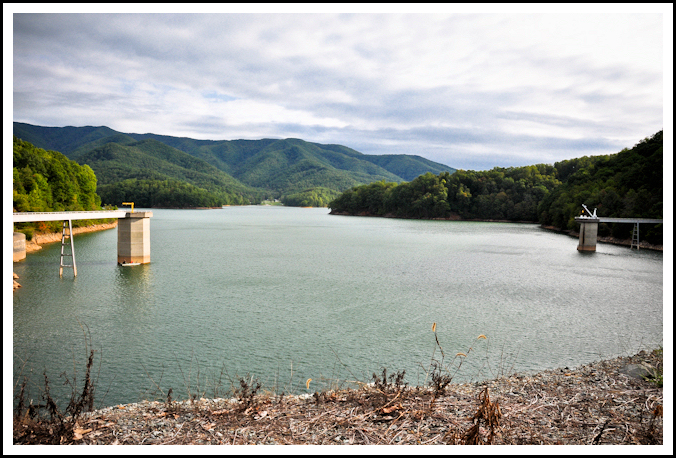
Watauga Dam Vista
Watauga Dam was completed in 1949 by the Tennessee Valley Authority, creating a very beautiful lake at 2000′ elevation. At the time of its construction, it was the highest elevation earthen dam in the world, and today it still remains as the highest in the eastern United States. What makes this area so picturesque is that much of the lake is surrounded by National Forest and the towering ridgelines of Iron and Pond mountains.
The Appalachian Trail crosses over top of Watauga Dam, so there are two different routes to get there. One way is to park at Wilbur Dam road and go south on the A.T. for 1.3 miles. The other is to park at Highway 321, just outside of Hampton, TN, and walk north on the A.T. for approximately three miles. I chose the latter route.

10" Diameter Mushroom Found on the Trail

Small Island Visable from a Section of Relocated Trail

More Views Along the Appalachian Trail
I had hiked this area many times before, but not in the past couple years. Since that time the TEHCC has re-routed much of the A.T. heading north to Watauga Dam, making it a much more pleasant hike, with less ups and downs and more of the trail following the lake’s shoreline.
View from Atop Watauga Dam
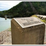
Monument on the Dam: Construction Completed in 1949
Another View from the Dam
This is a moderate hike easily accessible from Highway 321 in Hampton, TN. I highly recommend it for anyone, but especially new hikers in the Tri-Cities area who are looking to experience the A.T. without too much strenuous hiking or long driving. In a 6.0 mile round-trip hike, you’ll have awesome mountain and lake vistas, pass by an A.T. shelter, and walk on top of the highest earthen dam in the eastern U.S.
_______________________________________________________________________________
|
–

———————————-
Overall
Recommendation:
Beginning (or all) hikers looking for some less strenuous A.T. hiking, while having beautiful vistas and walking across a historical TVA dam.
–
Outstanding
Features:
Appalachian Trail, Appalachian Trail shelter, earthen TVA dam (highest elevation in eastern U.S.), and a beautiful lake.
–
Difficulty:
Easy to Moderate.
–
Driving:
From Elizabethton, take 19E toward Hampton. Once in Hampton turn left onto highway 321 toward Mountain City. Proceed approximately 2.0 miles and you’ll see the lake on your left. There will be a “Cherokee National Forest” sign immediately on your left with a large parking area.
–
Trails:
From the parking area, walk on down the road a bit toward the paved recreational area at the lake. There are restrooms there. Look for the white-blazed Appalachian Trail and take a left on it (heading north on the A.T.). Follow the white blazes and in approximately 3.0 miles you come to the dam. There is also an A.T. shelter about mid-way.
–
Needed
Gear & Tips:
It is almost always very windy on the dam. In cool conditions be prepared for these winds.
–
Distance:
Approximately 6.0 miles round-trip.
–
Time
Allotment:
3-5 hours
–
Type:
Out & Back.
–
Vista
Rating (1-5):
3.5 – Many medium grandeur views from lower elevations.
–
Waterfall
Rating (based on a 1-50 scale):
none–
–
Water
Crossings (one way):
A few very small streams, but you shouldn’t get wet. These streams are sometimes completely dry depending on weather conditions.
–
Scrambling/Climbing:
None.
–
Hazards:
Some steep slopes, one open footbridge.
–
Maps/GPS
info:
none
–
More
Information:
|
|


Bill, I enjoyed the article about in the JC press in today’s edition.
P.C. Snapp
Thanks so much, PC! Stop by the golf course sometime and visit!