|
–

———————————-
Overall
Recommendation:
Advanced hikers only with some navigational skills. Winter or early spring hike to avoid excess underbrush growth. Wait on a good rain before going.
–
Outstanding
Features:
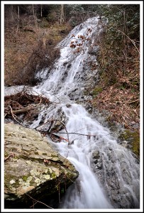
Remote waterfall.
–
Difficulty:
Difficult.
–
Driving:
From Johnson City: Take I-26 to the Erwin/Jonesborough exit (#37). At the end of the ramp turn right and take State Rt. 81/107 for 6.5 miles. Stay on Rt. 107 by turning left and continue for 5 more miles. Turn left onto Clark’s Creek Road and drive 3.9 miles into the Cherokee National Forest, all the way to the end of Clark’s Creek Road. There is a parking area here.
–
Trails:
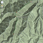
From the parking area, you will see a forest road across the creek. So, get out of the car and get wet… immediately making your first ford across Clarks Creek. Follow this forest road as it takes you upstream, and keep track of the number of times you cross the creek. After your 5th ford, you will go about 0.1 mile and you will come to a junction in the forest road (my GPS had this junction at 0.85 miles into the hike). Go left at this junction… continuing to follow Clarks Creek. You will then ford the stream a sixth and seventh time. After your 7th ford (you will be on the right side of Clarks Creek going upstream), go a few hundred feet and start looking for a feeder stream on the other side of Clarks Creek (coming in from the left side). This feeder stream (called Chigger Branch) should be easy to recognize as it is the first major stream feeding Clarks Creek on the left side. My GPS showed the point where Chigger Branch feeds into Clarks Creek at 1.1 miles into the hike. When you see Chigger Branch, you will need to cross Clarks Creek an 8th time to get over to it. From there, begin following Chigger Branch (going upstream) on the faint trail. I stopped counting creek crossings at this point because you will have to cross Chigger Branch numerous times, and sometimes it just depends of which side of the creek you decide to take. Regardless, just keep going upstream. The lower section of trail on Chigger Branch is decent (an old logging road) and seems to have been cleared out some recently, however there are still a few overgrown places that are tough to negociate. But, as you get further upstream the trail gets worse. At about 1.8 miles into the hike I came to a very overgrown section along the stream that was just about impassable, but I noticed a logging road off to my left about 60 feet above me on the side of the mountain. So, I climbed up to this logging road to get around the obstuctions. This logging road shortly drops back down to the stream at about 0.1 mile to go to the waterfall. This last tenth of a mile is a bushwack, and I mostly walked directly up the creek bed from this point. My GPS had the waterfall at exactly 2.0 miles into the hike.
–
Needed
Gear & Tips:
Trekking poles are basically a requirement to assist in the tough creek crossings. You will need them for stability in the quickly flowing stream. A GPS unit may be needed. And taking a hiking companion with you is a very good idea in this rugged terrain. Only go after a good rain so the waterfall will have decent flow. Take a waterproof bag for electronic equipment and some dry clothes in case you slip and get wet. Don’t wear jeans or cotton pants, especially in cool weather… wear quick drying hiking pants. Take slow, short steps while crossing the stream, and don’t try to “rock hop” in an attempt to stay dry. You WILL get wet so don’t risk hopping around and slipping… just go ahead and get your feet wet on that first crossing and get it over with.
–
Distance:
Approximately 4.0 miles round-trip.
–
Time
Allotment:
3.5-5 hours
–
Type:
Out & Back.
–
Vista
Rating (1-5):
1.0 – No elevated mountain views
–
Waterfall
Rating (based on a 1-50 scale):
Delsatch Falls: H(9) + F(4) + V(2) + W(3) + G(1+4+5) = 28–
–
Water
Crossings (one way):
Eight (very difficult), numerous (moderate to easy)
–
Scrambling/Climbing:
No rock climbing, but you will have some moderate climbing over and under fallen trees, and up and down steep banks.
–
Hazards:
Extreme slippery slopes and steep areas. Difficult bushwacking requiring some climbing and crawling. Difficult stream crossings, which could cause you to get wet. Take precautions to avoid hypothermia in cool conditions.
–
Maps/GPS
info:
Download Delsatch Falls Waypoint Here
–
More
Information:
Rattreks.com
|


8 Responses to Delsatch Falls