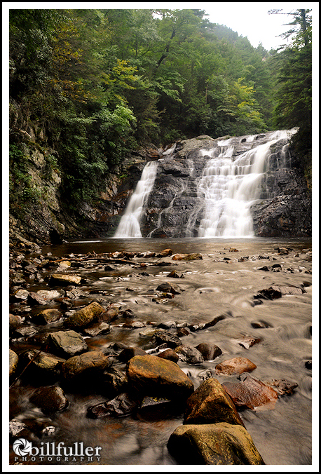
I use the system below to rank waterfalls in the region. This is not science… and much of it is purely subjective and based on my personal preferences. I simply use it to give people a starting point when deciding which waterfalls they want to visit.
The lowest score a waterfall can receive is “6”, while my perfect waterfall would score a “50”. Laurel Falls (pictured to the left) is ranked #1 in the east Tennessee region with a score of “38”. Note: I sometimes also give waterfalls a “combined” score if there are two or more waterfalls in viewable distance from each other (on the same stream).
_______________
Here are the criteria:
Height (H): Basically one point is given for each 10 feet of height. I round up, so if a waterfall is 35 feet, it scores a “4”. Waterfalls less than 5 feet will be given a zero for this rating.
Flow (F): 1-10 points are given for the average volume of water that you are likely to see in normal weather conditions. In other words it’s a rating of the water source that feeds the waterfall. It is another indication of the consistency of the waterfall even in dry weather conditions.
- Small drainage area (not a consistent stream, only flows in wet conditions).
- Larger drainage area (not a consistent stream, only flows in wet conditions).
- Very small stream (water flow is consistent but very low, normally a first order stream in higher elevations).
- Small stream (water flow is consistent but low, normally a first order stream in higher elevations).
- Medium stream (water flow is consistent and medium, normally a second order stream in middle elevations).
- Large stream (water flow is consistent and high, normally a third order stream in lower elevations, which is having three tributaries).
- Very large stream or small river (a fourth order stream).
- Medium river.
- Large river.
- Major river.
Vertical (V): 1-5 points are given for the vertical aspects of the waterfall.
- Mostly cascading with approximately 45 degrees or less to vertical, or vertical drops less than 10 feet.
- Mostly cascading with 45-75 degrees to vertical.
- Mostly cascading but almost vertical, or single vertical drops of 10-20 feet.
- Cascading plus some vertical drops of 10-20 feet.
- Vertical drops of over 20 feet.
- Less than 10 feet.
- 10-20 feet
- 20-30 feet
- 30-40 feet
- 40 feet or more
Grandeur (G): This rating is the most subjective, and 1-20 points will be given based on the beauty on the waterfall. To decide this rating I’ll ask myself the following questions:
- Viewing (1-5 points): How easy is the waterfall to view (this does not mean the hike to get there, but the actual area around the waterfall itself)? Can it be viewed from different areas and different angles, and from the top and the base? Can you explore around the waterfall? Can you see the entire waterfall? Is it blocked or hidden by trees, rocks, etc.?
- Surrounding Beauty (1-5 points) Is the scenery around the waterfall beautiful as well? Is it serene and secluded, or is it near a road or house?
- Uniqueness (1-10 points) Does it make you say, “wow” when you first see it? Does it have some aspect that sets it apart from other waterfalls regarding its shape or setting?


One Response to Waterfall Rating System