| Rocky
Fork Tract |
| |
|
|
|
August 9th, 2008 -
I was at the Rocky Fork Tract a few weeks ago on a guided hike
with David Ramsey (see here).
This hike mostly followed the forest roads, so I decided to return
alone and explore more of the off-trail areas of this beautiful place...
My first destination was
Whitehouse Mountain (elevation 3300'), which is just to the right of the entrance road into Rocky Fork.
This mountain had been on fire at some point, and the summit was
basically clear of trees, so I figured I'd get some great views
if I could make it to the top. I did make it, but it was a
tough bushwhack of about two miles round-trip (see detailed
trail description below if you want to try
this one). I spent some time at the summit, and hiked
on down the south face to Whitehouse Cliff where I had nice
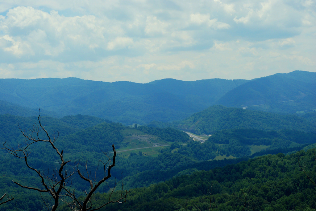
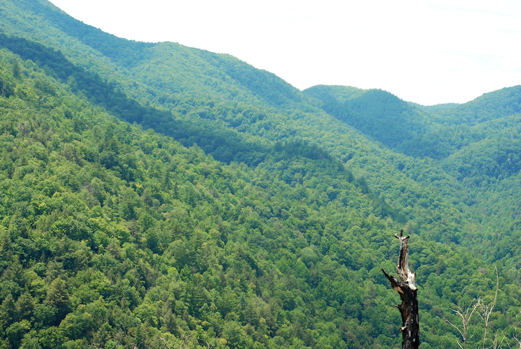
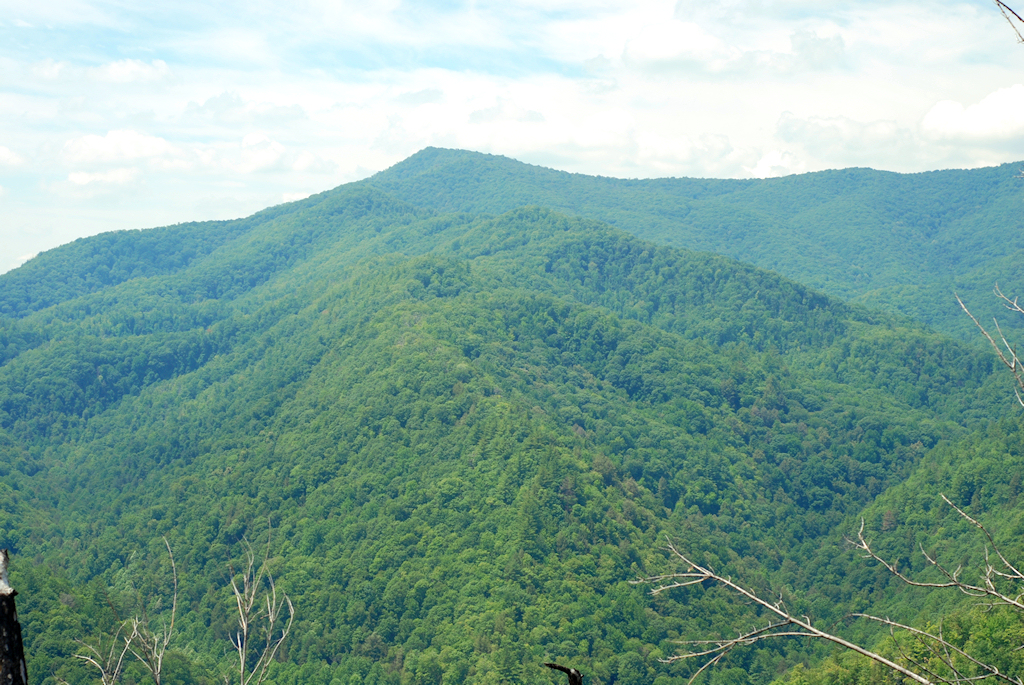
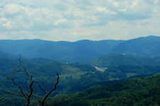
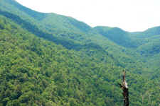
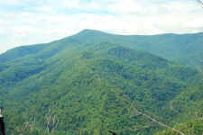
views. I also took a few
photos of the surrounding mountains... I had awesome vistas toward I-26 and overlooking the majority of the Rocky Fork
Tract. |
| |
|
|
|
|
|
View of the Flagpond Exit
on I-26 |
|
Looking Up at Flint
Mountain |
| |
|
|
 |
|
 |
|
The Snakeden Ridgeline |
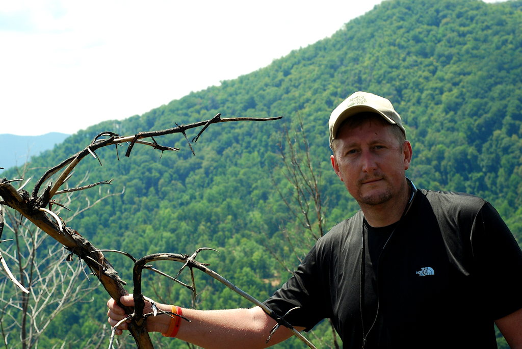
|
Bill on the Summit |
| |
|
|
|
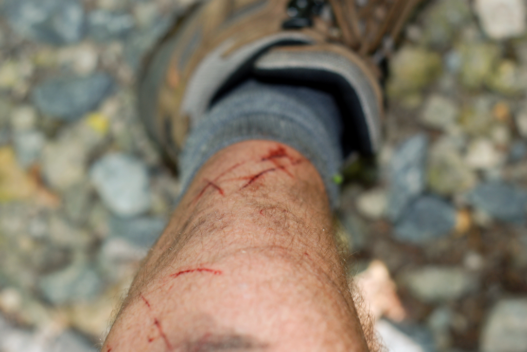
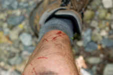
I made my way back down the
mountain to the graveled road, where I realized my legs were quite scratched
up from the climb. So I stopped for lunch, took off my boots, and
soaked my legs in the cool Rocky Fork stream. |
| |
|
|
 |
|
 |
|
Note to Self: Don't Wear Shorts
on a Bushwhack in August |
|
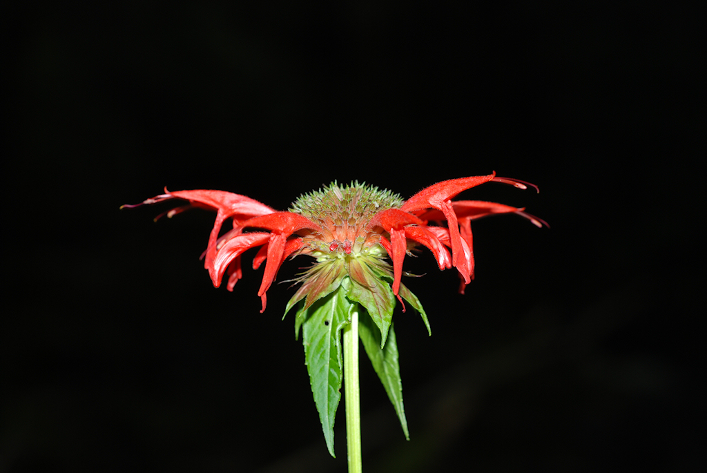
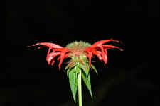
"Bee Balm" Growing on
the Banks of Rocky Fork... Thanks to
Ben Trotter for the I.D.! |
| |
|
|
|
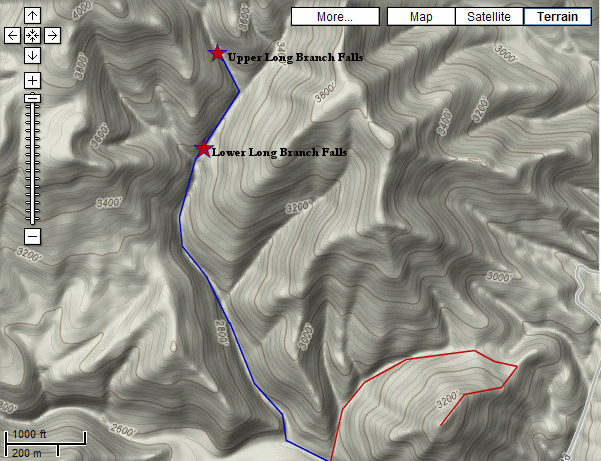
After my break for lunch I
continued on the graveled road ascending beside Long Branch. Once the
road made a sharp turn to the left, I went off-trail and kept following the
stream in search of Long Branch Falls. This turned in to another tough
bushwhack, which I wouldn't recommend for this time of year. The stream
banks were absolutely covered in Stinging Nettle, and the faint trail was
quite overgrown. In many places, I opted to walk directly up the
stream. And as the higher I climbed, the more the stream was basically
dry. When I arrived at Lower Long Branch Falls, it was just a trickle.
If you're going to do this hike, wait until after a good rain, and a good
frost to kill the weeds.
From the lower falls, I
continued on upstream to see if I could find Upper Long Branch Falls, but
the stream went virtually dry, and the bushwhack became very difficult... so
I turned around just a tenth of a mile short of the upper falls.
|
| |
|
|
 |
|
 |
|
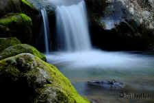
Lower Long Branch Falls Was Just a
Trickle |
|
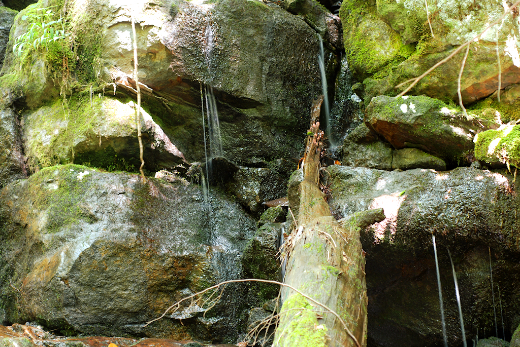
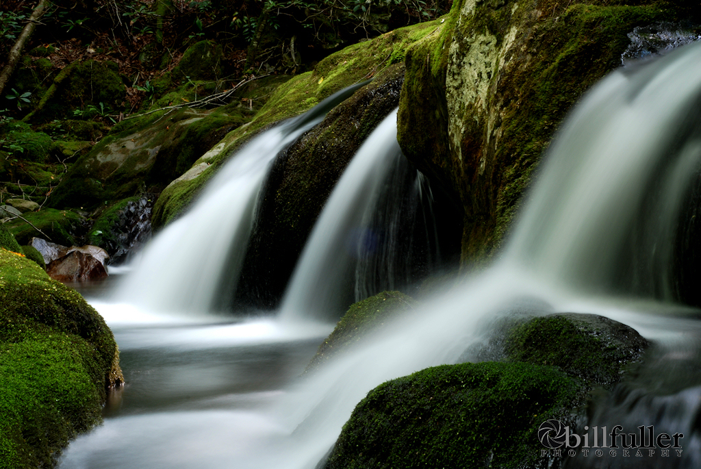
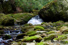
Cascades on Rocky Fork |
| |
|
|
|
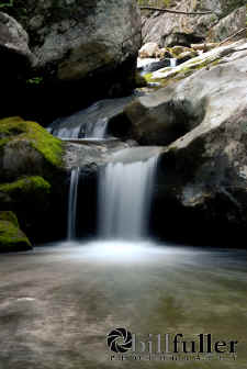
Upon returning to the Rocky
Fork stream, I spent a lot of time photographing the many cascades and small
falls before arriving back at my car. On the drive out, I also stopped
about .3 miles down the road and photographed the 10' Rocky Fork Falls. This
is really a wonderful place to explore. To read more about the Rocky
Fork Tract acquisition, and what you can do to help... read
here! |
| |
|
|
 |
|
 |
|
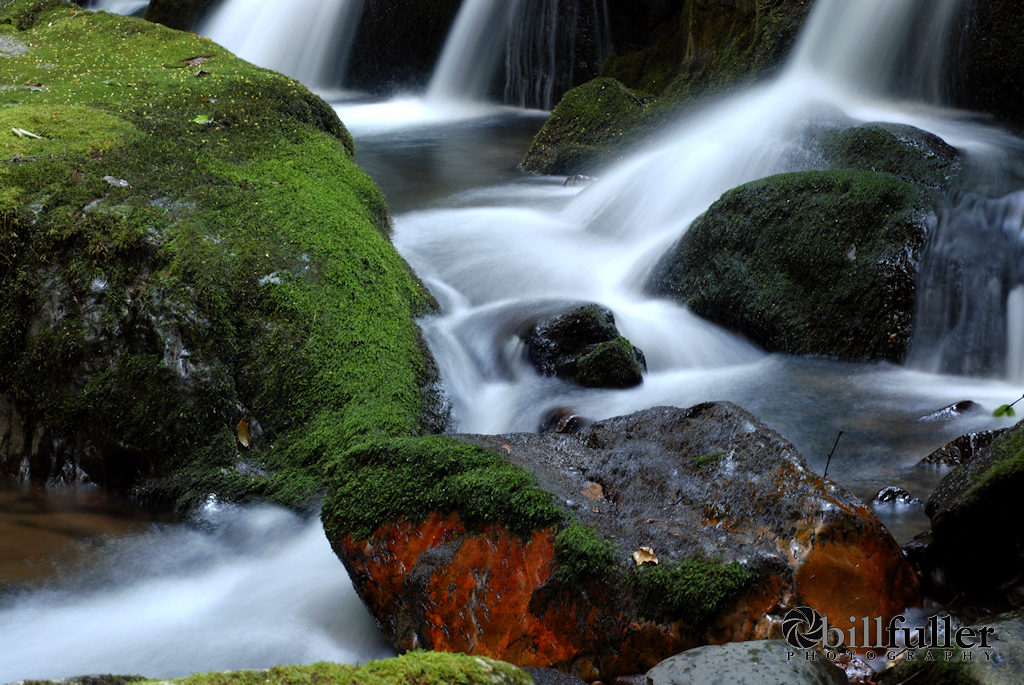
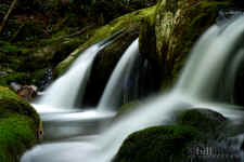
Serene |
|
Small Falls on Rocky Fork |
| |
|
|
 |
|
 |
|
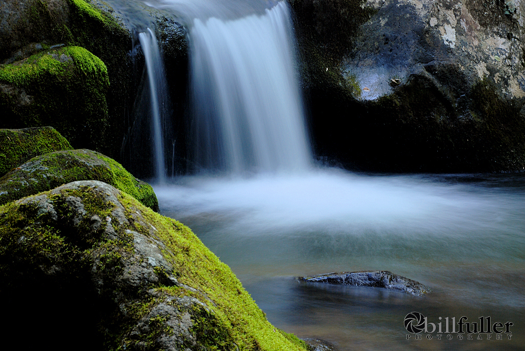
More... |
|
Rocky Fork Falls |
| |
|
|
 |
|
More of Rocky Fork Falls |
|
Total
Miles Hiked: 5.3
Getting There:
Driving
-
Take the Flag Pond exit off of I-26 (exit
#50). At the stop sign turn left onto Higgins Creek Road.
Drive ½ mile until you reach Rt. 23. Turn right and travel
2¼ mi. thru
Flag Pond, then turn left on Rocky Fork Road. After ¾ mi. you will
see a gravel pull-off to the left. Park here (out of the way of
the gate) and follow the gravel lane into Rocky Fork on foot.
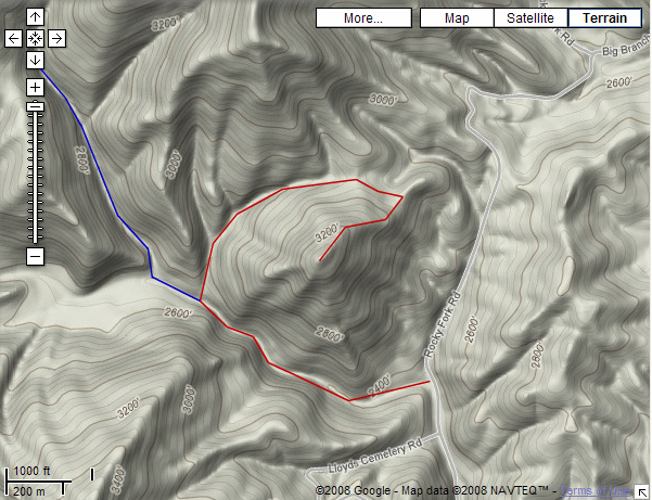
Trails
- Here is the route I used today to summit Whitehouse Mountain and
then to continue on to Long Branch Falls:
From the parking area, head out on
the graveled road. The Rocky Fork stream will be on your
left. After approximately 0.5 mile you'll see a primitive
trail on your right heading up a gap. Take this trail
which once seemed to be an old logging road, so it's in decent
shape. After approximately 0.6 miles of steady climbing
you'll reach a saddle (where the trail starts to descend again).
At that crest, look to your right and you'll see a trail heading into the underbrush. This trail is extremely
faint and overgrown (I think mostly used by animals). Take
that trail, working your way toward the left around the mountainside (basically without changing elevation). After
~0.1 mile you'll come to an opening with another forest road.
From here, I just climbed the mountain heading
straight up this ridge for another .25 miles. Once I
neared the top, it became very rocky and more difficult to
navigate though all the underbrush, so pay attention to your
route so you won't have to backtrack on your way out. From
my GPS it was about 2.0 miles from the graveled road to the
summit and back.
Once back at the road, turn right
and keep ascending for approximately 0.6 miles until the road
takes a sharp turn to the left. At this point, leave the
road by taking a right and go off-trail following the stream
(Long Branch). This is another faint trail that is quite
overgrown (at least it was this time of year). You'll be
required to make a few stream crossings and even wading up the
middle of the stream. Go another ~.35 miles and
you'll come to a fork in the stream. Take the right fork
and Lower Long Branch Falls is almost immediately on your right.
Continue on up the stream for another 0.2 miles, until it forks again, and
go 0.1 miles up the
left fork to go to Upper Long Branch Falls. Making a
straight trip from the car to the upper falls would be about 3.5
miles round-trip.
|
 |
 |
|
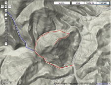
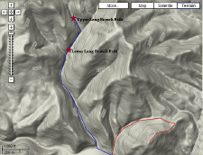
Red Line Shows Route
to Whitehouse Mtn. |
Blue Line Shows Route
to Long Branch Falls |
|
|
HOME |
|