|
April
24th, 2008 -
If you are looking for a wonderful family hike with some
beautiful scenery, this has to be one of the best in the east
Tennessee area. It has
two of the most grand waterfalls in our region with Elk Falls
and Jones Falls, while much of the trail also follows the
beautiful Elk River. You will also spend a couple of miles
on a nice section of the Appalachian Trail... all within a
moderate ~3.5 mile round trip.
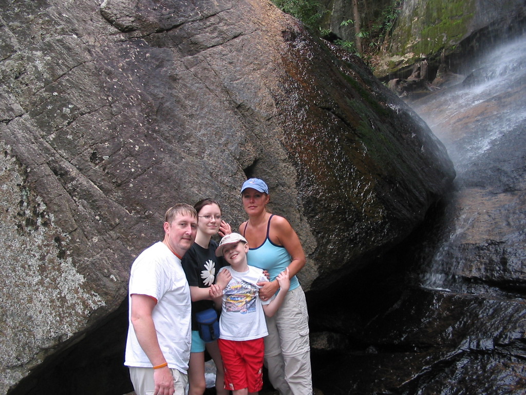
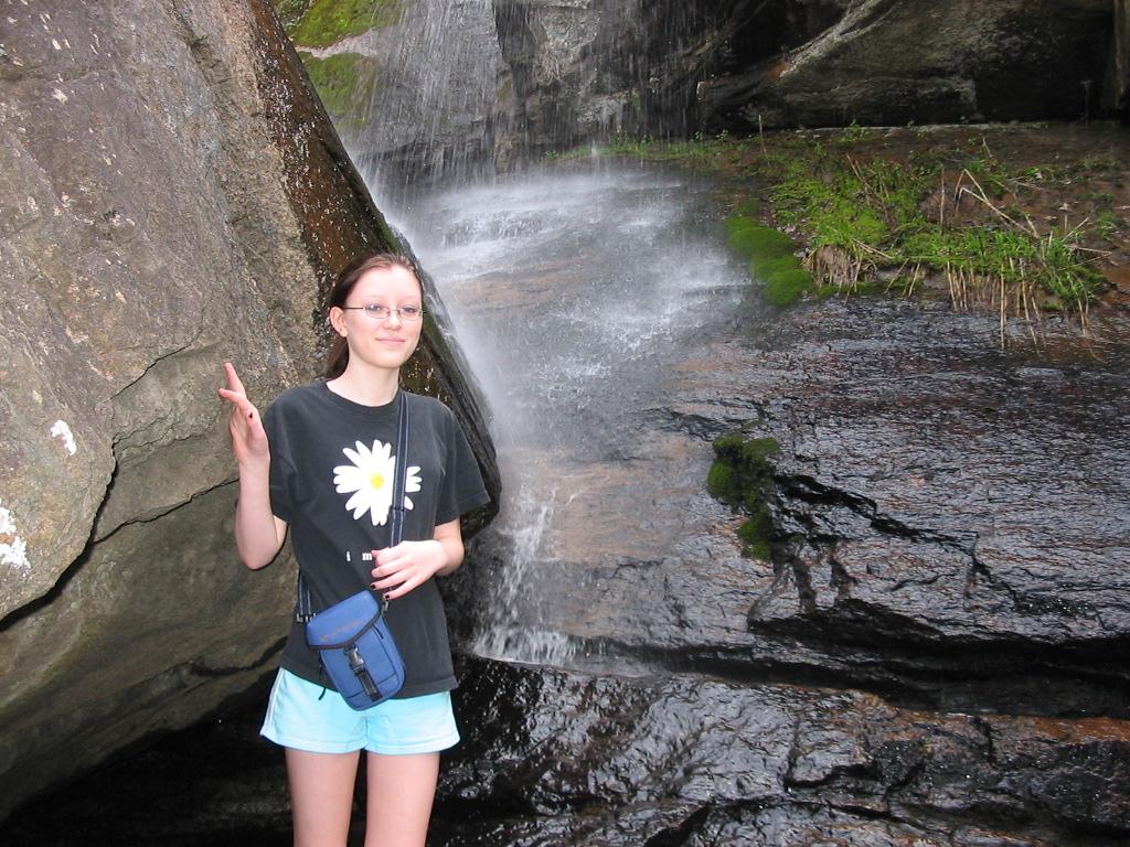
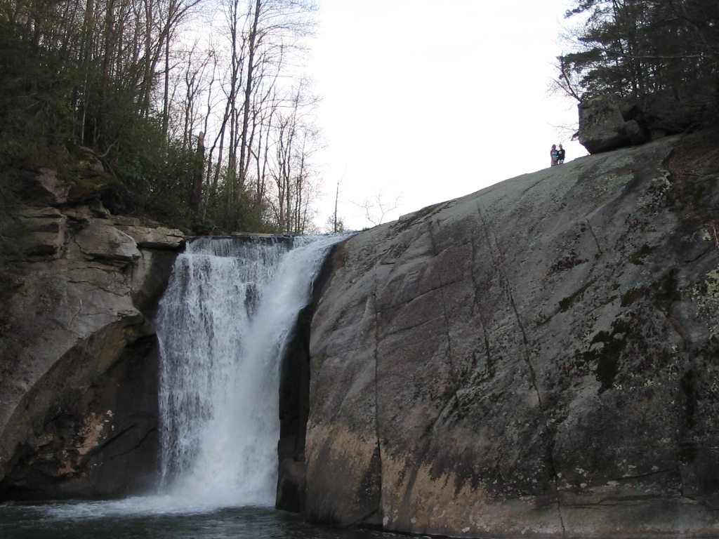
All of the Fullers came out for
this one, and we had a great time. We began at the ~50'
Elk Falls (also see
here for
past photos), which is easily accessible from the road. We
then continued along a somewhat overgrown trail until we reached
the A.T. (see detailed hiking directions below as it can
be tough finding the A.T. from Elk Falls). From there we
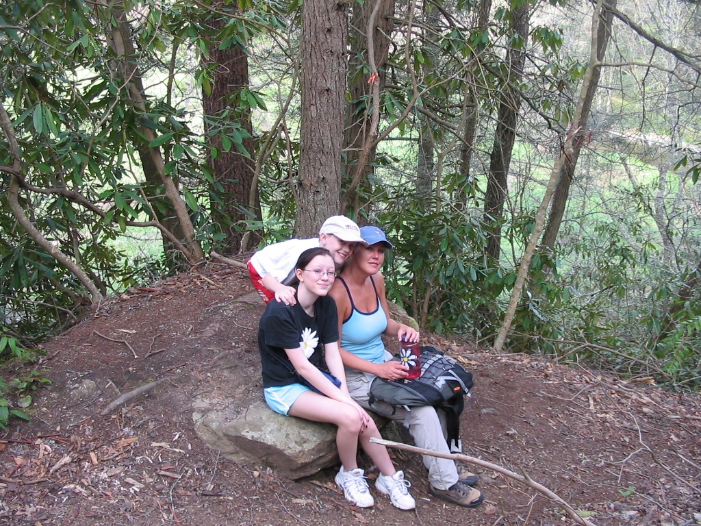
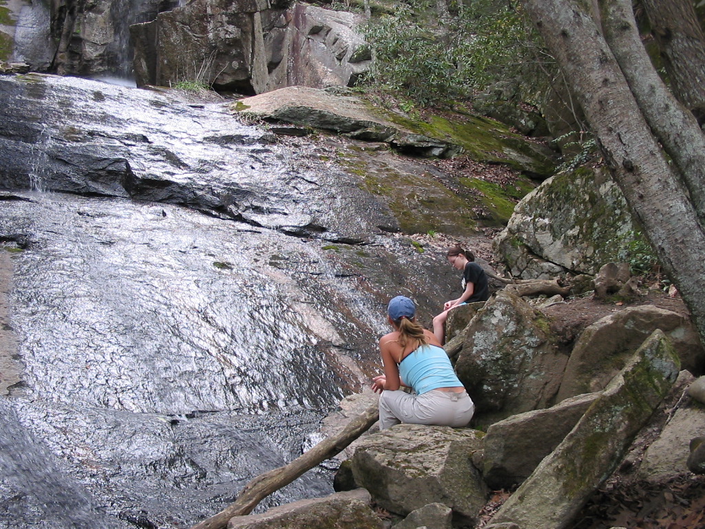
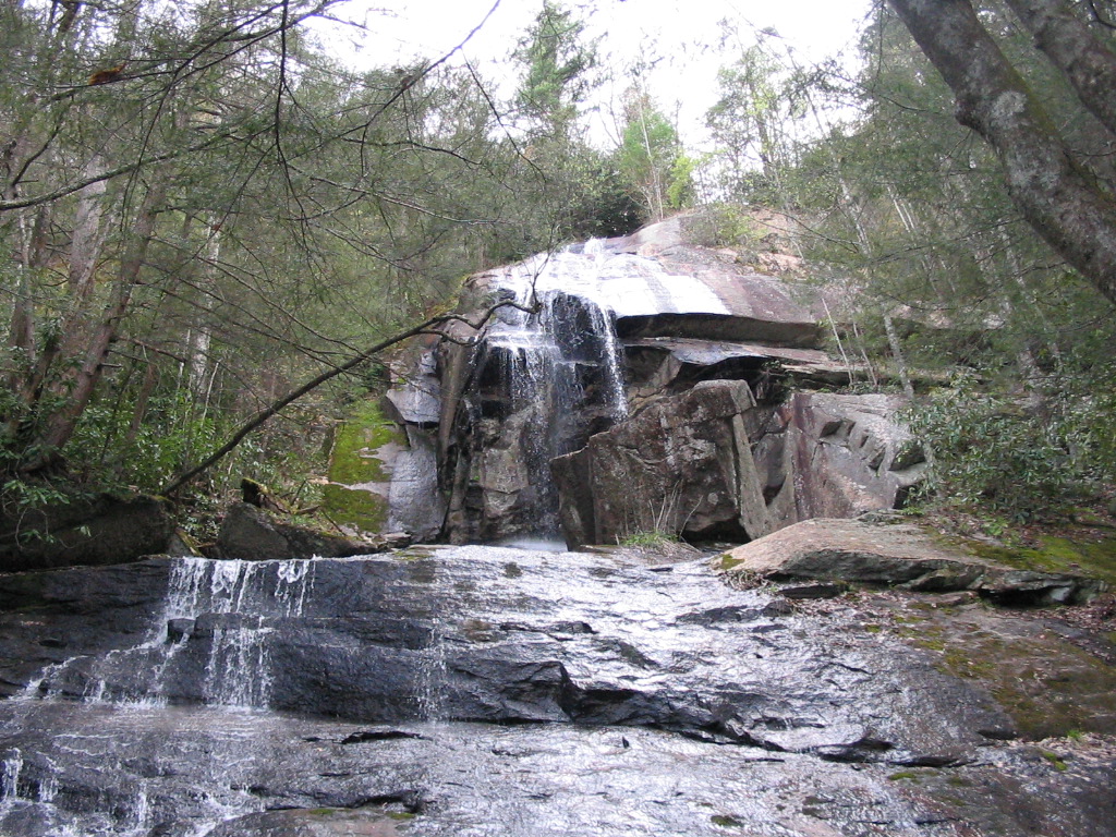
went south on the trail and soon made our way up to the 100'
Jones Falls. We stopped for a break, and then
climbed on up to the second tier, and spent some time taking
photos. |
|
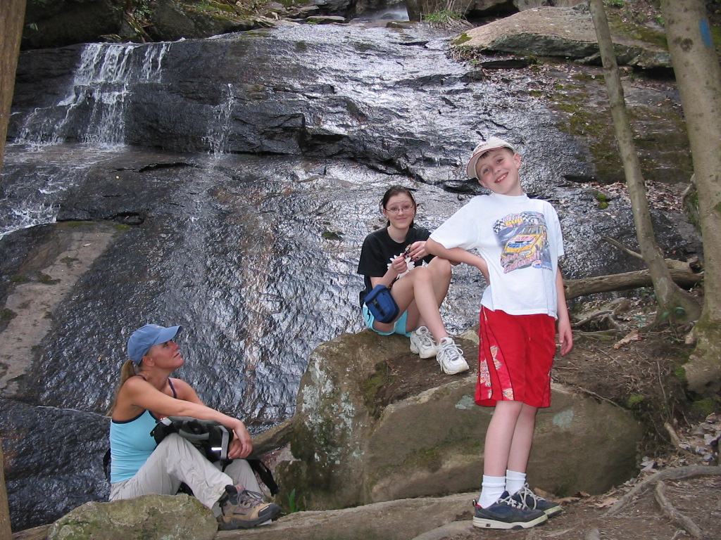
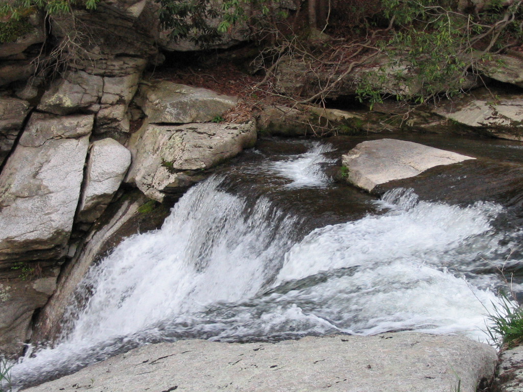
Jones Falls is a high elevation
waterfall, so it's flow is very dependant on rainy weather. It
has been a little dry for a couple of weeks so it wasn't flowing
all that great, but it was very nice nevertheless (See
here
for more Jones Falls photos with higher water flow).
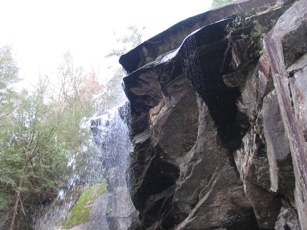
After leaving Jones Falls, we made
our way back to Elk Falls by returning on the A.T. and then
taking the forest road. We stopped again to view
this magnificent waterfall before driving home. Unlike
Jones Falls, the flow of Elk Falls was great. Shannon and
Taylor stayed on the top ledge, while Campbell and I climbed
down to the plunge pool to take their photo. |
|
Again, this is a good family hike
that can be done in only 2-3 hours. For best viewing of
Jones Falls, go soon after a decent rain, and read the hiking
direction below so you won't lose the trail.
Total
Miles Hiked: 3.6
Getting There:
Driving
- From Elizabethton, take 19E east and continue on
through the town of Roan Mountain and into North Carolina.
Just before getting into the community of Elk Park, turn left
onto Old Mill Road (there's a black sign there for Elk Falls,
but it's hard to read). Go about .25 mile on Old Mill
Road, and then take a left onto Elk River Road. Follow it
for four miles into the Pisgah National Forest, to a parking at
the end of the road. Trails
- Begin on the yellow-blazed trail from the parking
area. This is a very short and highly traveled trail,
which is approximately .2 mile to Elk Falls. After the
falls, you have two options in order to continue on to find the
Appalachian Trail (and eventually Jones Falls)...
You can return to the parking area
and set out on the gated forest road, or you can do as we did,
and follow the unmarked, slightly-overgrown trail directly
downstream from Elk Falls. This trail is overgrown and not
maintained, but it is defined well enough that you should be
able to stay on it as it follows Elk River heading downstream.
After .5 mile or so, you will run into the forest road (which is
now where you'd be if you simply took the forest road from the
parking area). Turn right on this road and follow it until
it meets (fords) Elk River. At this junction, you will see
a grassy field on your left with faint or no signs of a trail.
Walk ~100 yards through this grassy field, still following the
river. At the end of the field, walk toward the bank of
the river, and you should be able to see the trail continue
directly alongside the river bank. We had to cross over
some limbs and brush here. The trail then continues along
the bank for a few more hundred yards until the river takes a
strong turn to the right. At this point the trail will
leave the river and head into the forest to the left.
Almost immediately you will make any easy ford across Jones
Branch, and then you will make a steep climb for for another
couple hundred yard up to the junction of the Appalachian Trail
(there's a big rock right in the middle of the trail at the
junction). Turn left here on the A.T. and follow it for
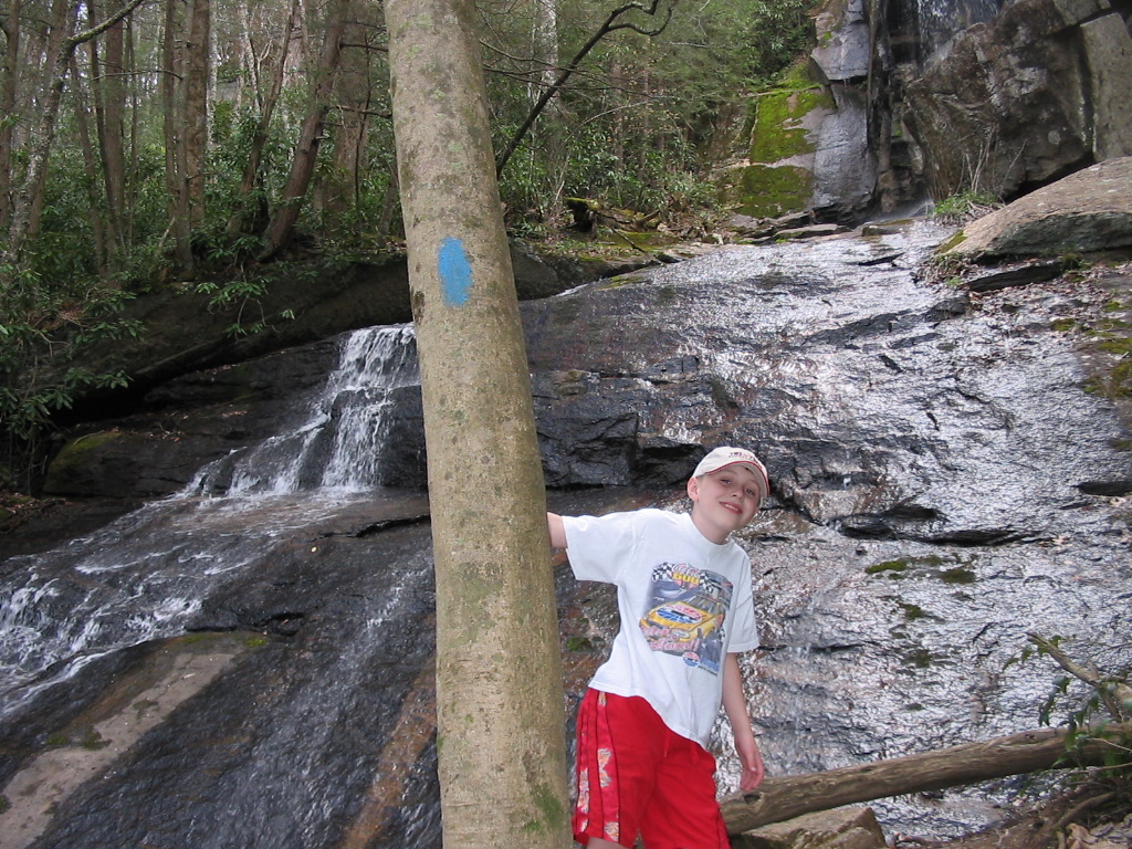
about ~3/4 mile until you reach a blue-blazed trail on the left.
Follow this blue-blaze for ~.2 mile to Jones Falls. My GPS
mileage for the entire trek from the parking area to Jones Falls
was 1.75 miles.
Download my GPS Track for Elk
Falls to Jones Falls via the unmarked trail, and the waypoints
for Elk Falls, Jones Falls, and the A.T. Junction
here
(.gpx format... Right click on link and chose
"Save Target As"). |