browser icon
You are using an insecure version of your web browser. Please update your browser!
Using an outdated browser makes your computer unsafe. For a safer, faster, more enjoyable user experience, please update your browser today or try a newer browser.

Rocky Fork to Birchfield Camp Lake – Mtn Bike

Posted by on August 21, 2011

Rocky Fork Trio Waterfall

A few months ago I found Birchfield Camp Lake (elevation 4000′) in the Rocky Fork Tract via the Higgins Creek route.   This time I decided to see if I could find it coming in from the main gate at Rocky Fork.  This is a longer route, and since my knee is still tender, I decided to give it a try on the mountain bike.

Rocky Fork is newly acquired National Forest, so accurate trail maps are very limited.  There are a series of forest roads winding through the 10,000 acre tract so I took my GPS unit and a little knowledge from past hikes in this area, and set out.

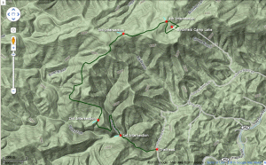
The ride from the trailhead along the Rocky Fork stream is very pleasant.  After taking a right at my first road junction (see map below for my route and junctions), the climb got tougher.  I was able to stay on the bike most of this section, but after I reached the second road junction the trail became very steep and less maintained in some areas.  I simply didn’t have the stamina to stay on the bike in this area as the trail rises from 3000′ to 4300′ in less than a couple miles.  So from junctions #2 to #3, I walked the bike the vast majority of the time.

Rocky Fork Trailhead

Cascade On Rocky Fork

Checking the GPS

Once you reach the top of Higgins Ridge (the highpoint of the trip at 4300′) it’s downhill again to the 3rd road junction.  Man, was I happy to finally be back on the bike! After the 3rd junction there was a some ride-able up and downs, before the 4th junction.  From there it’s a very steep final descent down to this very secluded lake.  If you decide to go on this trip review my trail notes below very carefully because the roads were a little confusing, especially up around the lake area.  If you have a GPS unit you can also download my track in the Hike Planner below.

After circling the lake I had to push the bike back up to the ridge, but then had a very fun downhill ride all the way back to the car.  My GPS showed that I’d traveled about 11 miles round-trip.

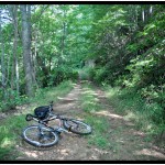
About Half Way Up

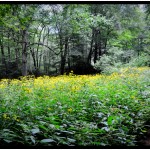
Fields of Tall Coreopsis Near the Lake

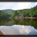
Birchfield Camp Lake


Click to Enlarge

_______________________________________________________________________________

———————————-

Overall
Recommendation:

Advanced hikers or mountain bikers with very good fitness level.

Outstanding
Features:

Small waterfall. High elevation lake.

Difficulty:
Difficult. 2000+ feet of elevation gain.

Driving:
Take the Flag Pond exit off of I-26 (exit #50).  At the stop sign turn left onto Higgins Creek Road. Drive ½ mile until you reach Rt. 23.  Turn right and travel 2¼ mi. thru Flag Pond, then turn left on Rocky Fork Road. After ¾ mi. you will see a gravel pull-off to the left. Park here (out of the way of the gate) and follow the gravel lane into the Rocky Fork Tract.

Trails:
Refer to the map, as ALL road intersections are shown!  Also download GPS track below.  From the parking area , go though the gate and head out on the graveled road.  The Rocky Fork stream will be on your left.  You will come to the first junction in the road at approximately .75 mile, where you need to bear right.  Continue uphill for another ~.75 mile to the second intersection. Take a right here.  At this point the road becomes much steeper.  Continue climbing for another couple of miles until you reach Higgins Ridge at 4300′.  You will then descend slightly for 0.5 mile or so to the 3rd intersection. Take a right here and travel about a mile to the 4th intersection.  Take a right at this 4th intersection, and in only 50 feet or so the road will split again.  Both of these roads head down to either side of the lake… circling the lake.  So you can take either (or come out at either).        

Needed
Gear & Tips:

I took a mountain bike, but hiking it would be fine.  Take some extra water.  Don’t forget your map. 

Distance:
Approximately 11.0 miles round-trip.

Time
Allotment:

Biking: 4-5 hours  Hiking:  5-7 hours

Type:
Out & Back.

Vista
Rating (1-5):

2.0 – Occasional views through the trees. Nice view of Frozen Knob at the lake.

Waterfall
Rating (based on a 1-50 scale):

Rocky Fork Trio: H(1) + F(6) + V(1) + W(2) + G(3+3+6) = 22

Water
Crossings (one way):

None, but some big mud puddles.

Scrambling/Climbing:
None.

Hazards:
Take precautions to avoid hypothermia especially in cool conditions.  Weather can change dramatically at high elevations.

Maps/GPS
info:

(right click on link, and chose “Save Target As” or Save As”. Download to your hard-drive and then upload to your GPS unit)

My .gpx file to get from Rocky Fork to Birchfield Camp Lake

More
Information:

2 Responses to Rocky Fork to Birchfield Camp Lake – Mtn Bike

  1. Mac Alasdair

    hey thanks for the directions….i’ve been wanting to go there for awhile but never was sure exactly how to get there…i’ll try the higgins creek directions next time. i provided a link to your directions on my blog…hope that’s ok… http://macalasdair.blogspot.com/2013/09/rocky-fork-to-birchfield-camp-lake.html

Leave a Reply to Bill Fuller Cancel reply

Your email address will not be published. Required fields are marked *

This site uses Akismet to reduce spam. Learn how your comment data is processed.