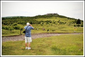
Dad Taking Photos on the Appalachian Trail Near Massie Gap
First, I want to apologize for the lack of posts lately. I went on a 4-day backpacking trip about a month ago and injured my knee, so I haven’t been out much since that trip. I hope it is healing up so I can get back out on some longer hikes very soon.
I’ve made it a little tradition to go hiking with my dad on Father’s Day for the past few years, and this year we decided to drive up to the Grayson Highlands State Park in southwest Virgina and hike up to the A.T. from Massie Gap. Dad had never seen the feral ponies in this area, so I figured Massie Gap would be the best chance of that.
We made it up to the A.T. via the 0.8 mile Rhododendron Trail, and we did get to see the wild ponies as soon as we crested the ridge, but unfortunately it came a downpour only moments later. So, we rushed back to car instead of exploring more along Appalachian Trail as originally planned. Dad really enjoyed the area, so we are planning a return trip.

Sleeping Feral Pony

Vista from Massie Gap
_______________________________________________________________________________
|
–

———————————-
Overall
Recommendation:
Great short hike for beginners or children. And Massie Gap seems to be the best bet for running into the feral ponies.
–
Outstanding
Features:
Virginia State Park, Appalachian Trail, Feral Ponies, Vistas, Southern Appalachian Balds
–
Difficulty:
Easy.
–
Driving:
From Interstate 81, take exit 35 (Chilhowie), turn onto route 762 Whitetop Rd. (at the bottom of the exit turn toward the Hardees). Continue on 762 for approximately 11.5 miles, then take a left on Route 600 (Whitetop Road). Follow this road for approximately 8.0 miles, then take a left on Highway 58. Follow Highway 58 for 7.5 miles, and then take a left into the Grayson Highlands State Park on Route 362. You will soon pass through a toll gate. Follow the signs to the Massie Gap parking area.
–
Trails:
From the parking area, you will see a trail leading through an open field. This is the Rhododendron Trail. Follow this blue-blazed trail as it leads you up the ridge. After 0.7 miles of ascending, you will come to graveled road (which is the VA Highlands Connector horse trail). Take a left on this “road” and in 0.1 mile you will come to the junction of the Appalachian Trail (there is a sign here). Dad and I had intentions of taking a right on the A.T. (heading north), but the rain stopped us at this point.
–
Needed
Gear & Tips:
Weather can change dramatically on the grass covered peaks, so take extra clothing.
–
Distance:
1.5 miles.
–
Time
Allotment:
1 hour.
–
Type:
Out and back.
–
Vista
Rating (1-5):
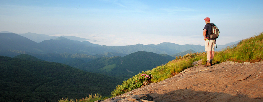
3.5 – Great views near Massie Gap, but for even better views continue on the A.T. up to Wilburn Ridge.
–
Waterfall
Rating (based on a 1-50 scale):
None–
–
Water
Crossings (one way):
None.
–
Scrambling/Climbing:
Only if you want to climb the numerous rock outcroppings.
–
Hazards:
Weather can change dramatically on the grass-covered, exposed ridges. Check forecast for high winds or thunderstorms before attempting to camp on exposed ridge-lines or peaks.
–
Maps/GPS
info:
none
–
More
Information:
|
|


