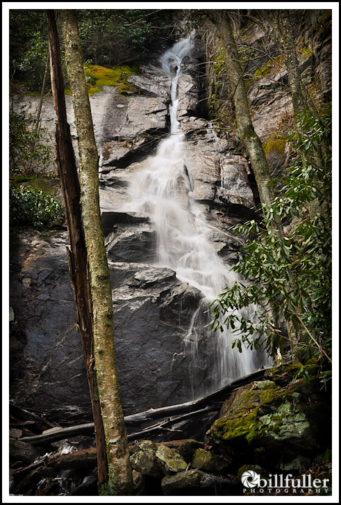
Coon Den Falls
If you happen to be hiking to the popular Laurel Falls in the Dennis Cove area, be sure to check out the short trek to Coon Den Falls as well. I’ve seen this waterfall usually listed at 50 feet high, but I think it’s more like 80 feet as much of the upper falls are not visible due to underbrush. There is also another smaller waterfall on the hike up, but it’s not very accessible to photograph.
I had not visited Coon Den Falls in a couple of years, but noticed on my recent trip that many improvements have been made to the trail. The climb up is still quite steep, but the trail is clear and now has nice steps in some areas where ropes used to be. It’s only 0.5 miles so it’s well worth the climb, and with mountain streams at high levels right now, it would be a great time to visit this awesome waterfall!

Areas of Renovated Trail
_______________________________________________________________________________
|
–

———————————-
Overall
Recommendation:
Short hike to a beautiful waterfall after a good rain.
–
Outstanding
Features:
Waterfall.
–
Difficulty:
Moderate.
–
Driving:
Take Route 19E to the town of Hampton, TN. When in Hampton, go North onto Highway 321 toward Mountain City and Watauga Lake. In 0.8 miles take a right on Dennis Cove Road. Follow this road for 4.0 miles and you will come to the popular trailhead for Laurel Falls. Continue past the Laurel Falls Trailhead for another 0.6 miles, and look for a blue-blazed trail on your right. There is not a parking area here, but there is enough of a wide spot on the left side of the road to park a vehicle.
–
Trails:
After parking, simply follow the blue-blazed trail heading into the forest. In approximately 0.5 miles of steady climbing you will reach the waterfall.
–
Needed
Gear & Tips:
Bring trekking poles to help with the steep climb and descent.
–
Distance:
Approximately 1.0 miles round-trip.
–
Time
Allotment:
One hour
–
Type:
Out & Back.
–
Vista
Rating (1-5):
1.5 – Very limited elevated mountain views
–
Waterfall
Rating (based on a 1-50 scale):
Coon Den Falls: H(8) + F(3) + V(3) + W(1) + G(1+3+3) = 22–
–
Water
Crossings (one way):
None.
–
Scrambling/Climbing:
None.
–
Hazards:
Slippery slopes and steep areas.
–
Maps/GPS
info:
None.
–
More
Information:
|
|


The last two times I hiked the trail, I hiked up the AT and back on Coon Den. There was no snow on Dennis Cove Road. But as soon as I reached the top of the ridge there was a foot of snow. I ended up sliding down most of Coon Den Trail because of ice.
The Forest Service has made some big improvements to the Coon Den trail recently. Maybe you won’t have to slide down it anymore. 🙂
I enjoy Coon Den more so than Laurel falls simply because of its uniqueness.
Yes… during the wet conditions it is awesome!
Couldn’t find the trail head for coon den, but ended up hiking up to Dennis cove falls while it was frozen. It looked awesome.
It’s very hard to see the trailhead, James. But, after you cross the Appalachian Trail on Dennis Cove Road (at the Laurel Fork trailhead), it’s about 0.6 mile on down the road. It’s on your right, and there is a Cherokee NF trail sign there. There’s barely enough room on the left side of the road at that point to park your car, but I have parked there. Glad you made it to Dennis Cove Falls though!!!