Appalachian Trail on Round Bald
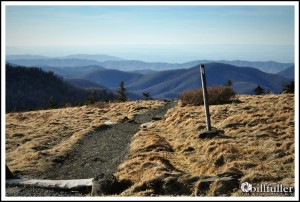
If you’re looking for a short walk to amazing vistas, check out the summit of Round Bald in the Roan Highlands. This is a 5826′ elevation mountain with 360 degree-panoramic views. The hike is entirely on the Appalachian Trail and is only a mile trek (round trip). See my Hike Planner below for all the information and directions.
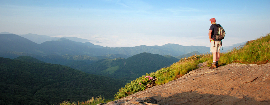
This is a also great place for landscape photography. I visit this area often to capture wonderful mountain views, fall colors, sunrises and sunsets… and in early June, masses of Catawba Rhododendron are in bloom in the entire Roan Mountain area. It is simply a wonderful place to visit and photograph.

Grassy Summits of Big Hump & Little Hump Mountains

Vista from Round Bald
_______________________________________________________________________________
|
–

———————————-
Overall
Recommendation:
Awesome short hike with panoramic vistas.
–
Outstanding
Features:
Southern Appalachian Bald, Appalachian Trail, Masses of Catawba Rhododenron.
–
Difficulty:
Easy.
–
Driving:
Take Route 19E to the town of Roan Mountain, TN, then turn onto Route 143 toward the Roan Mountain State Park. Proceed 12.8 miles to the TN/NC state line. This is Carver’s Gap. There is a parking lot on your right.
–
Trails:
From the parking area, cross the road and immediately look for the white blazes of the Appalachian Trail. Follow these blazes heading north on the A.T. In 0.5 miles you will summit Round Bald. There is a post with a sign indicting the elevation.
–
Needed
Gear & Tips:
Prepare for heavy winds and much cooler temperatures so bring extra clothing… maybe even a jacket in the summer months. Temperatures will be 10-15 degrees cooler than in the low lands.
–
Distance:
1.0 mile round-trip.
–
Time
Allotment:
One hour.
–
Type:
Out and back.
–
Vista
Rating (1-5):
5.0 – This is as good as it gets in the Southern Appalachians.
–
Waterfall
Rating (based on a 1-50 scale):
None–
–
Water
Crossings (one way):
None.
–
Scrambling/Climbing:
None.
–
Hazards:
Weather can change dramatically on the grass-covered, exposed ridges. Check forecast for high winds or thunderstorms before attempting to summit this peak.
–
Maps/GPS
info:
none
–
More
Information:
See more photos here
|
|


