|
–

———————————-
Overall
Recommendation:
Very adventurous one-night backpacking trip, with numerous stream crossings. Do it in low water conditions only (most likely the summer months).
–
Outstanding
Features:
Five waterfalls, old railroad grade, beaver dams, Appalachian Trail, A.T. Shelter, potential fishing.
–
Difficulty:
Very difficult (this is a rating of of how strenuous the hike is by elevation gain).
–
Driving:
Take Route 19E to the town of Hampton, TN. When in Hampton, go North onto Highway 321 toward Mountain City and Watauga Lake. In 0.8 miles take a right on Dennis Cove Road. Follow this road for 4.0 miles and you will come to the popular trailhead for Laurel Falls, which is also the Appalachian Trail. Continue past the Laurel Falls Trailhead for another 0.9 miles, and you’ll see a parking area on your left just before crossing the bridge. Park here.
–
Trails:
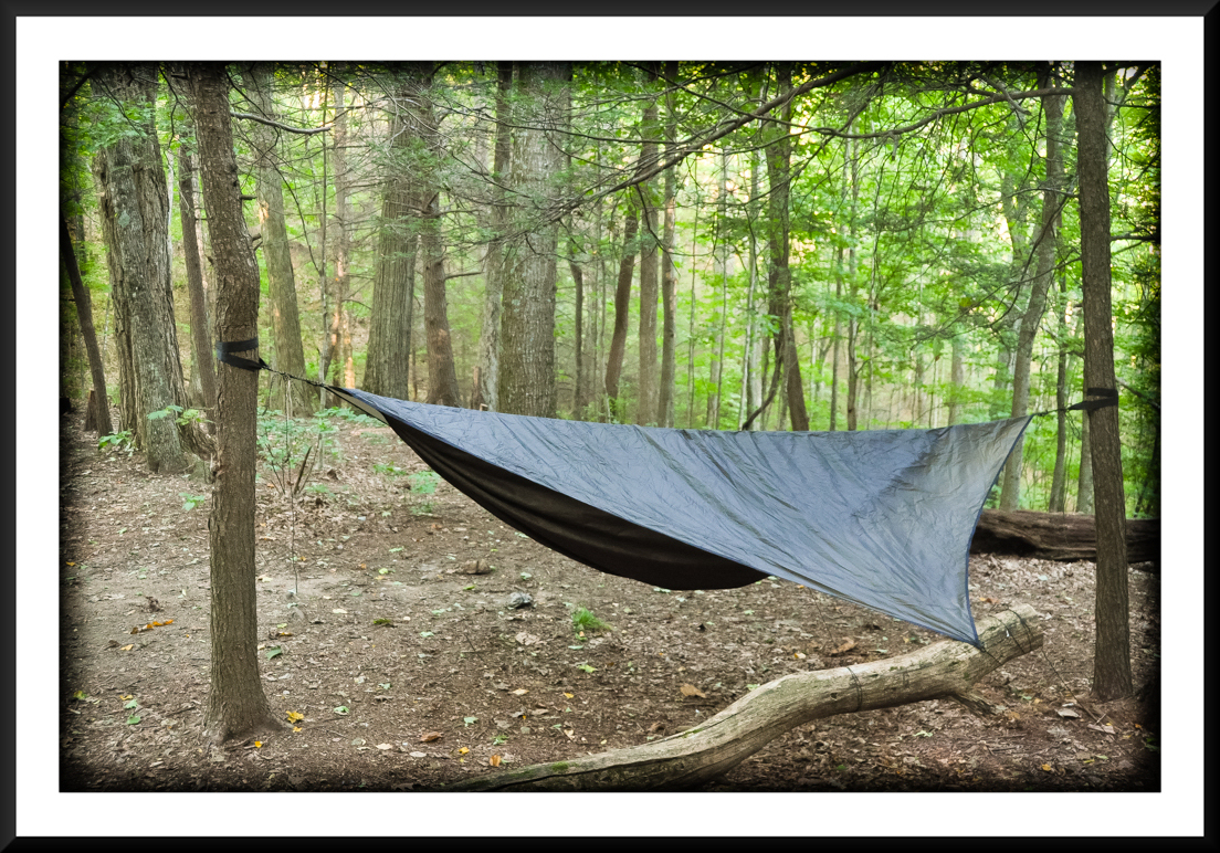
From the parking area, walk to the bridge (and check the water level!), and you’ll see the trailhead next to the bridge marked with Cherokee National Forest sign (CNF Trail #39). Follow this blue-blazed trail (some places it is yellow-blazed). You will need to make three initial stream crossings. After the 3rd stream crossing, there is soon a spur trail that you will see leading down to the right. This goes to Lower Dennis Cove Falls. Return and continue on up the trail, where you will come to a rock outcropping with a small ledge. Almost immediately after this outcropping you will see another spur trail leading down to the right. This is the trail to Upper Dennis Cove Falls. This is at the 1.6 mile mark. Continue on upstream where the fords become more difficult and the trail becomes more rugged. Soon you will reach the open fields of “Frog Level”. Blazes end at the open fields, and sometimes it’s difficult to see the trail. Therefore, when the trail comes out to the first open field, continue in a straight line across the field, and you will see the trail continue into the forest near the far left corner. At the second open field also continue in a straight line and the trail will resume again in the adjacent forest. After a stream ford you will finally come to the third open field. Again, just keep going straight… all the the to the end of the field where there is a junction with the Lacy Trap Trail. Continue on the Laurel Fork Trail heading upstream where you continue to make numerous fords, and go through rugged areas. You will soon come to Upper Laurel Fork Falls. It will be on your immediate left, and has a short spur trail. You will hear it! Soon after that you will come to Campbell Falls. It will again be on your left and you will hear it as well. After approximately 7 miles on the Laurel Fork Trail, you will come to a junction WITH A SIGN. The signs points left to Cherry Flats and right to Bitter End. GO RIGHT toward Bitter End. This will put you on a little grass covered forest road for a few hundred yards, and then you will pop out on a graveled forest road (#293). There is no signage here… You will need to go LEFT on this gravel road! After approximately .75 mile, you will see the Appalachian Trail crossing this road. Keep an eye out for white blazes. When you see the A.T., take a RIGHT on it… heading A.T. North. From here there are numerous campsites, and springs usually flow well in this area, often crossing the A.T. I hiked on to Moreland Gap Shelter and camped there, which was about 4.5 miles after I got on the A.T. Following Moreland Gap Shelter, continue north on the A.T. for an additional 4.5 miles, and you will see a sign indicating the Coon Den Falls Trail, leave the A.T. and take a right at that sign. WARNING: The Coon Den Falls trail is VERY steep and can be slippery. After about .8 miles you will reach the 100′ Coon Den Falls. Continue on down the trail another .5 mile and you will come out on Dennis Cove Road. Take a right, walk a couple tenths of a mile, and you will be back at your car.
–
Needed
Gear & Tips:
Backpacking gear, and a map of the area showing trails and forest roads. Trekking poles help tremendously in making the stream crossing. Optional fishing gear. If fishing, only single-hook, artificial lures are allowed on the Laurel Fork Trail.
–
Distance:
Approximately 18.5 miles.
–
Time
Allotment:
2 days
–
Type:
Loop.
–
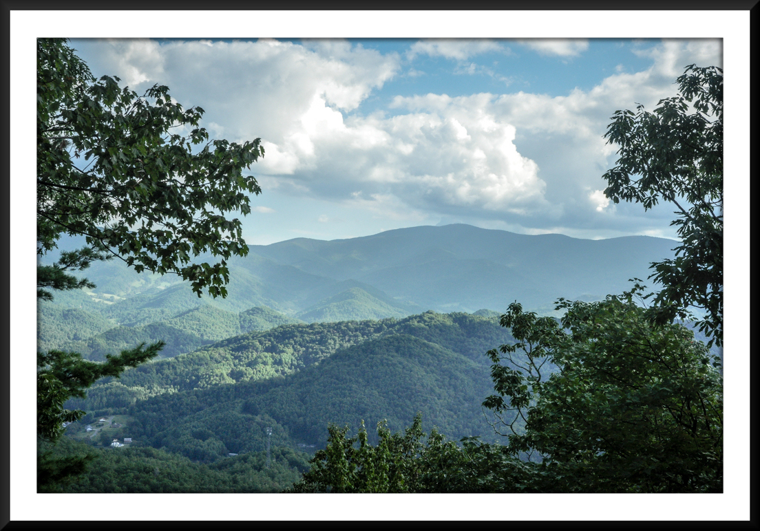
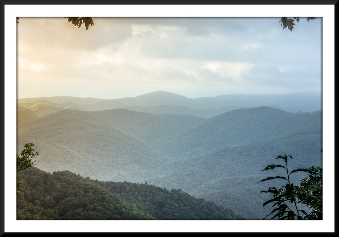
Vista
Rating (1-5):
3.0
–
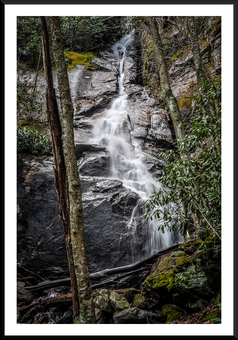
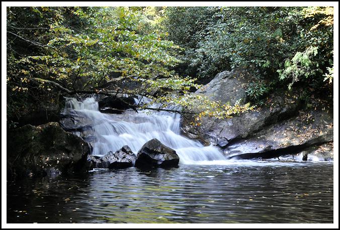
Waterfall
Rating (based on a 1-50 scale):
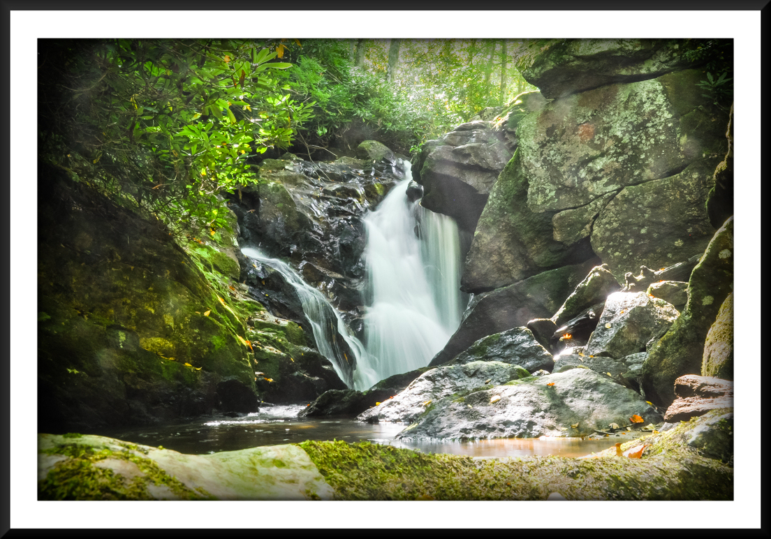
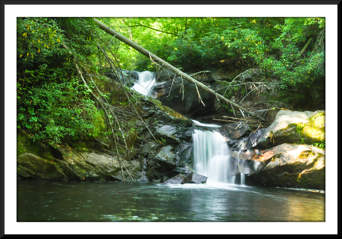
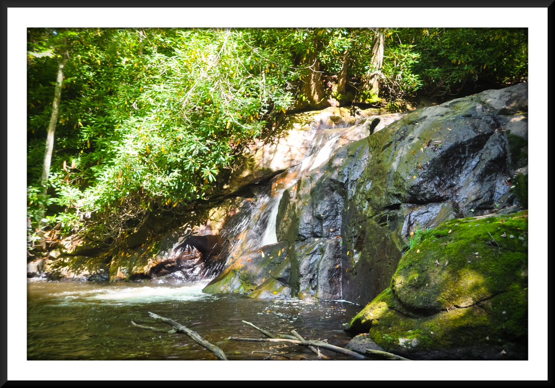
Lower Dennis Cove Falls: H(1) + F(7) + V(1) + W(2) + G(2+4+3) = 20
Upper Dennis Cove Falls: H(2) + F(7) + V(2) + W(2) + G(3+5+7) = 28
Upper Laurel Fork Falls: H(3) + F(7) + V(4) + W(1) + G(2+5+7) = 29
Campbell Falls: H(2) + F(7) + V(3) + W(1) + G(1+4+2) = 20
Coon Den Falls: H(8) + F(3) + V(3) + W(1) + G(1+3+3) = 22
–
–
Water
Crossings (one way):
Very Difficult. NUMEROUS (I lost count but probably in the teens). Plan on getting wet to knee deep or more. These crossings can be dangerous in high water conditions. At the trailhead, look at the stream under the bridge at Dennis Cove Road. If it’s more than shin deep at that bridge, do NOT go on this hike.
–
Scrambling/Climbing:
Moderate. A few short scrambles on the spur trails to the waterfalls, with steep and slippery slopes, and/or moderate climbing. Some handholds required on the Coon Den Falls Trail.
–
Hazards:
Again… take extreme caution on the stream crossings and do not go on this hike if water levels are above shin deep at the bridge at the road. I have heard the area dammed by the beavers can sometimes require a waist or chest-deep ford. Use extreme caution! There were also a couple of overgrown areas that tore up my legs with briars. In addition, the upper end of the Coon Den Falls Trail is extremely steep, requiring hand holds and sure footing. Be careful!
–
Maps/GPS
info:
–
More
Information:
|


