Adventures in the Southern Appalachians & Beyond!  


HIGHWAY 321 TO WATAUGA DAM
     

February  22nd, 2009 - I had a chilly hike to Watauga Dam on Sunday.  I started at the Shook Branch recreational area off of Highway 321 at Watauga Lake and went north on the Appalachian Trail.  This hike basically follows the lake, climbing up and down on the surrounding ridgeline until eventually reaching the dam.                 


003.jpg (657320 bytes)


004.jpg (814180 bytes)

Watauga Lake... Taken Near the Dam

  Highest Earthen Dam in the Eastern U.S.
     

After 2.9 miles I reached the historic dam built in 1949.  At the time of it's construction it was the highest earth dam in the world... it still remains as the highest in the eastern U.S.


The temperature was in the 20's, and with the wind chill it was much colder.  It was so extremely cold and windy at the dam that I didn't walk out on it.  For this reason I also couldn't bring myself to take many photos.             

     
018.jpg (696766 bytes)   022.jpg (891757 bytes)
Small Island on Watauga Lake   Snow Covered Trail
     
023.jpg (556832 bytes)
View of Iron Mountain
     

Total Miles Hiked:  5.8 


Getting There (to Laurel Falls from Dennis Cove):  


Driving - From Elizabethton, take 19E toward Hampton.  Once in Hampton turn left onto highway 321 toward Mountain City.  Proceed approximately 2.0 miles and you'll see the lake on your left.  There will be a "Cherokee National Forest" sign immediately on your left.  This is where I parked.    


Trails - From the parking area, walk on down the road a bit toward the paved recreational area at the lake.  There are restrooms 
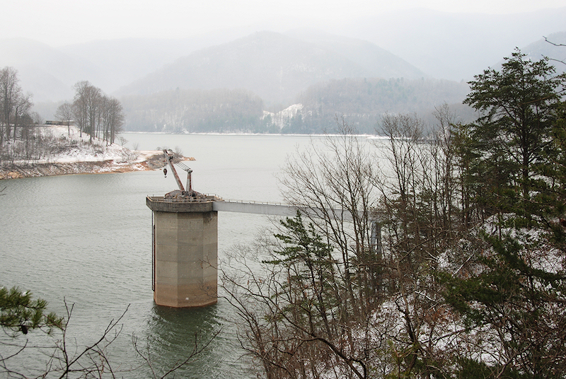
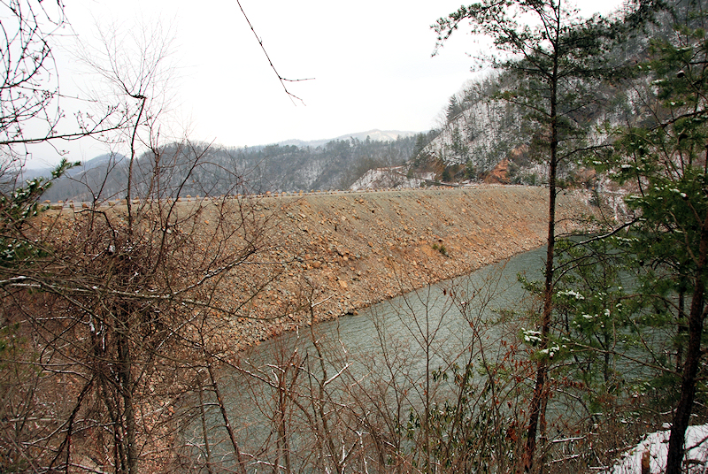
there.  Follow the white blazes (north on the A.T.).  In 2.9 miles you come to the dam.  There is also an A.T. shelter about mid-way.     


Hike Rating -


Bill's Overall Rating:

Distance:  5.8 miles

Difficulty:  MODERATE

Type: OUT & BACK

Vista Rating: 

Waterfall Rating:  NONE

Water Crossings:  2-EASY

Scrambling/Climbing:  NONE

Hazards:  one short open bridge, slippery slopes

Significance:  historical, Appalachian Trail, structure, A.T. shelter

Recommendation:  average


Click here for hike rating reference guide.


Copyright © 2007  All Right Reserved.  All Images, Logos, and Photos are the property of

HikingBill.com or Bill Fuller Photography