| PINNACLE
MOUNTAIN - WASHINGTON COUNTY TN HIGHPOINT |
| |
|
|
|
March
6th, 2008 - Pinnacle
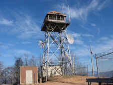
Mountain is very recognizable as it has one of the last of three
remaining fire towers in all of the Cherokee National Forest
sitting on its summit. It's also the highpoint of
Washington County, Tennessee at an elevation of 3520 feet.
For
the past 15 years I've looked up at Pinnacle Mountain almost on
a daily basis from my place of work (Buffalo Valley Golf Course
in Unicoi), but today was my first trip to the top of this
mountain. And I did it the hard way...
|
| |
|
 |
|
|
|
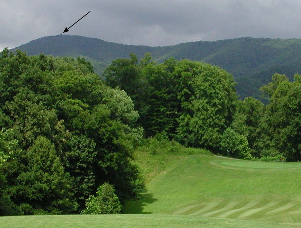
Pinnacle Mtn... Taken From the Golf Course Last Summer (Arrow
Shows the Fire Tower) |
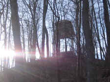
|
View of the Fire
Tower Through the Trees |
| |
|
|
|
The summit/tower can normally be
reached by driving up a forest road off of Dry Creek Road, but
the gate was closed so I parked my car (at 2000' elevation) and
set out on foot. I think I would have done it this way
regardless of the gate, as I wanted this highpoint to be a true
climb.
The first 2.5 miles ascended
steadily on a graveled road until it crossed over "Briar
Creek" in a gap. It was here that the road split, so
I got in my backpack to look for my map, and I realized that I'd
brought the wrong one. And guess what? Somehow I'd
deleted the Pinnacle Mountain waypoint from my GPS too. So
I was clueless on which way to go, but I decided to take the road to the
left. |
| |
|
|
 |
|
 |
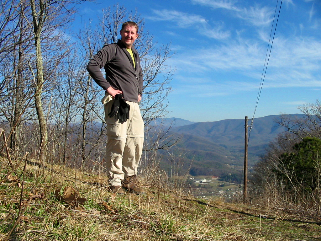
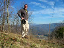
| Bill
on the Summit of Pinnacle Mountain... Washington County's
Highpoint @ 3520' |
|
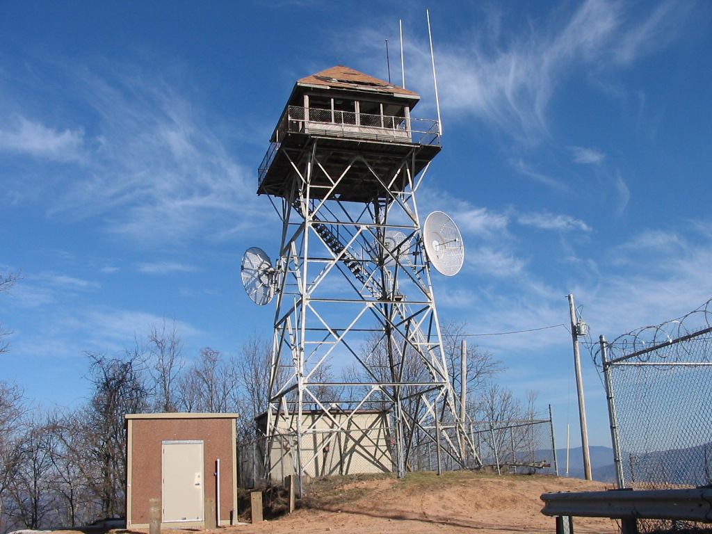
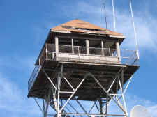
The
Fire Tower on Pinnacle Mountain |
| |
|
|
|
From here the road got worse with
gullies and rocks... to the point that you would probably need a
high clearance vehicle if you were driving it. After
another 1.5 mile or so of more climbing, I came to another
intersection in the road, and I decided that with the odds of
picking the correct road twice, I probably wouldn't find the
summit today. It was just a few seconds later that two
mountain bikers came down the road to my left and stopped to
talk. One of the bikers was very familiar with the area
and pointed me toward the road to my right.
After another ~1.5 miles on this
road I reached the summit of Pinnacle Mountain. As seen in
the photos, the fire tower needs lots of repairs, but plans are
in the works to completely refurbish this tower along with
adding a hiking trail, and then open it to the public as a
lookout tower (read
more here). The steps to top of the tower have been
torn down, and I didn't even think about trying to climb it, so
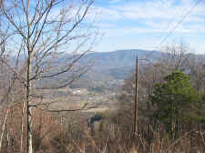
my views weren't all that great. But I did have a nice
vista toward Unaka Mountain through the powerline cuts, and I
could vaguely see my golf course through the trees. I took
a few photos and returned down the mountain. My GPS
registered 11.0 miles round
trip with an elevation gain of over 1500'. This completed
my 4th East
Tennessee County Highpoint. |
| |
|
|
 |
|
 |
| Needed
Repairs |
|
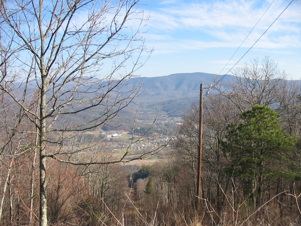
View
of Unaka Mountain from the Powerline Cuts |
| |
|
|
 |
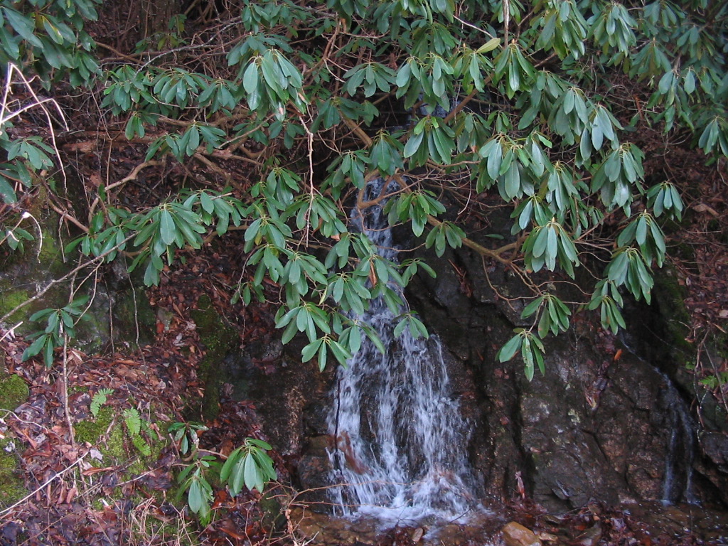
|
Small Waterfall Next to the Forest Road |
| |
|
|
|
Directions: In Johnson City,
take Cherokee Road (off of University Parkway, next to Pine Oaks
Golf Course). Go a few miles and then take a left directly
across from Cherokee Middle School onto Lone Oak Road (which
eventually turns into Dry Creek Road). Go approximately
5.5-6.0 miles after turning at Cherokee Middle School, and
you'll see a forest service road with a gate on your
left. |
| |
|
|
|
Total
Miles Hiked: 11.0 |